

We all have access to many different software packages to enable us to achieve different tasks. For example, we need to sketch out a basic proposal, do detailed designs and product documents and information for setting out. We also need to share that information within our organisation, with other partners on the project, with clients and often with the public.
In this blog I want to highlight some of the connected workflows within our Civil Engineering suite of tools. Let’s start with sketching out your proposal. Here are 2 tools available for sketching out your plans. The one you choose will depend on your requirements.
Forma Site Design
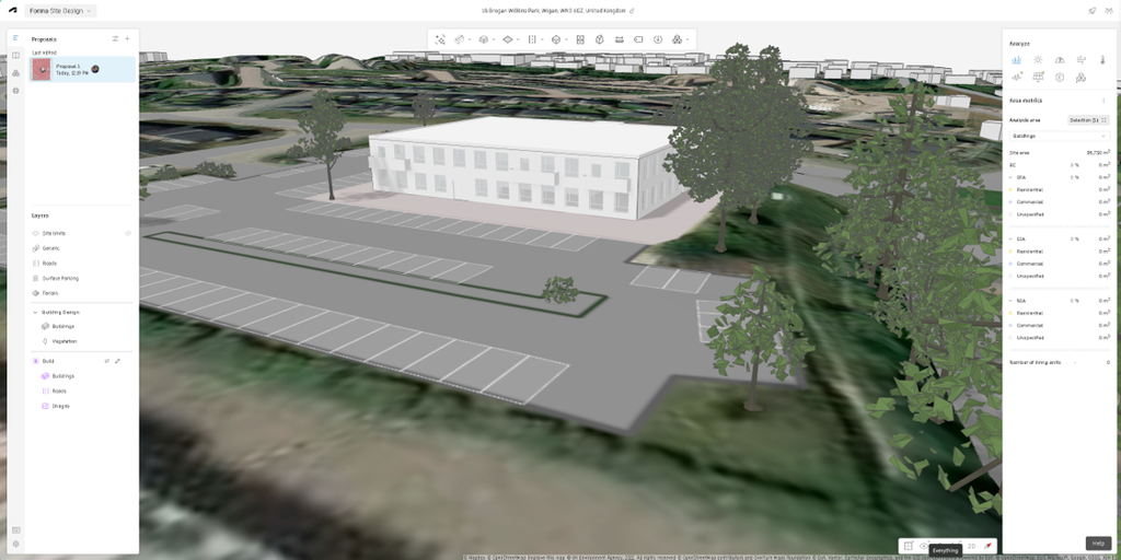
This is the front end to Forma (formerly known as the Autodesk Construction Cloud), where you can access mapping data such as Open Street Map, Landform data which comes from the Open Government site, and aerial imagery from Bing Maps or ESRI.
I’ll be doing a deeper dive into the Civil tools in Forma in another blog, so for this one I’m just looking at the tools available to you that you might not have considered.
This is ideal for analysing your site for things like solar, wind and noise to name just a few. Architects can also use this tool to sketch out building plans and then move this data directly into Revit.
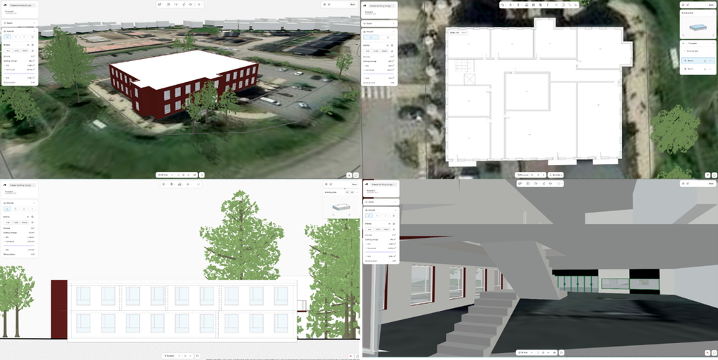
Forma also has Forma Building Design for conceptual buildings. Forma Building Design will allow you to create buildings at the conceptual stage that contain Revit elements such as floors, windows, doors and stairs. There are more, but as I say, this is the high-level view of the tools.
Revit
InfraWorks
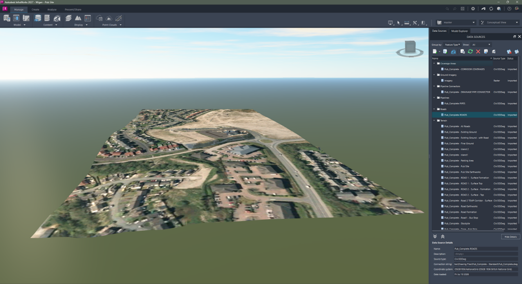
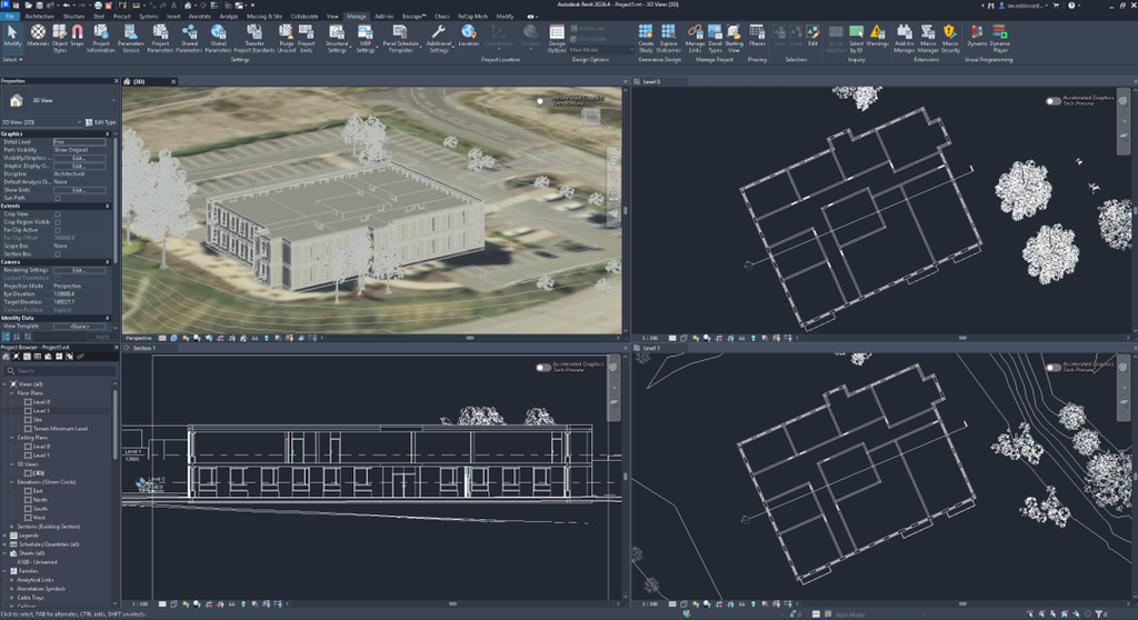
InfraWorks is an ideal partner tool for Civil 3D users. You can sketch out your design using any data you can procure or create and share your design intent. Once you have produced a plan, you can open this model in Civil 3D. Just go to the InfraWorks tab in Civil 3D.

From here, you can do your detailed design and documentation in AutoCAD Civil 3D.
Vehicle Tracking
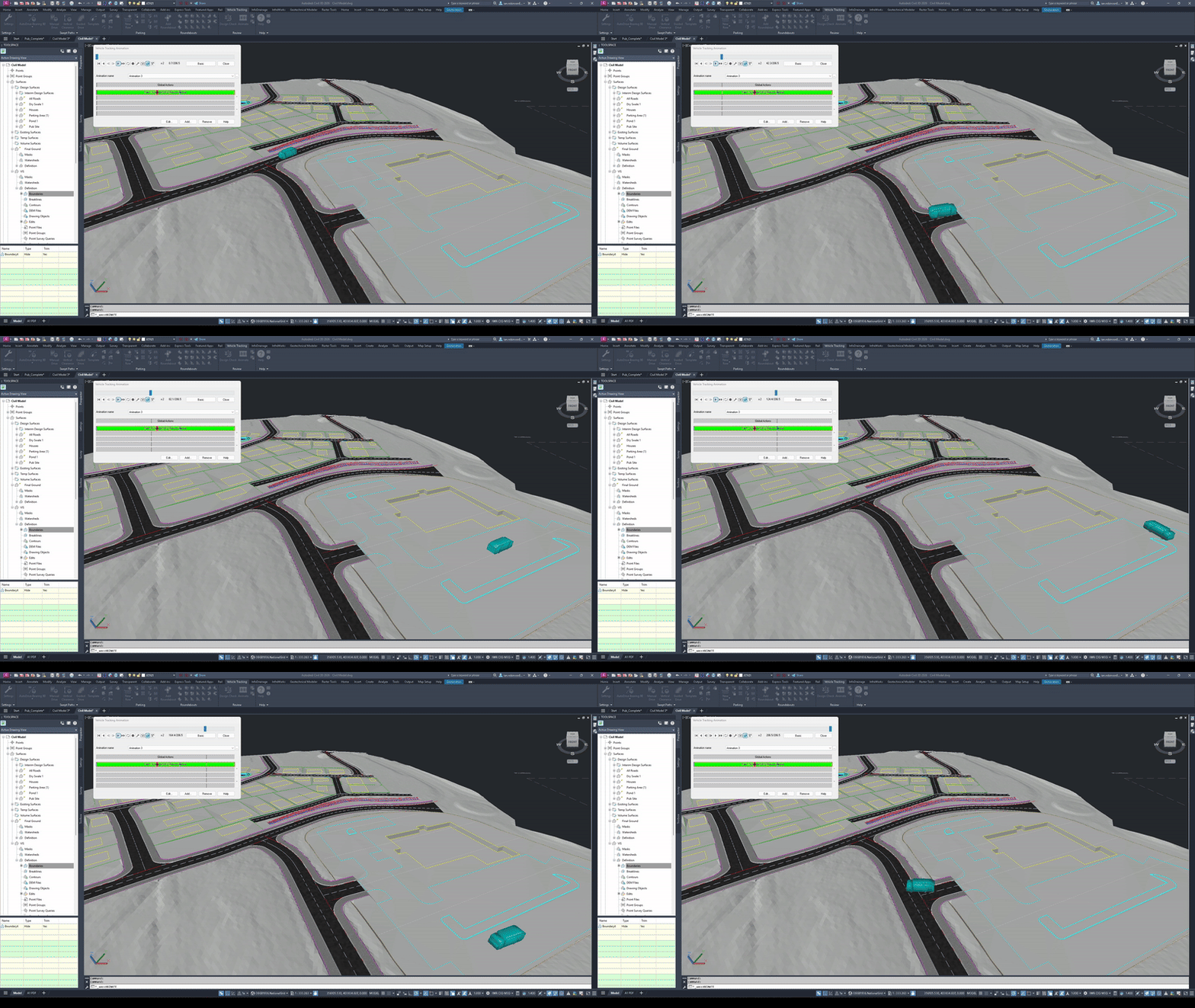
This is basically build into AutoCAD if you have purchased the right package and installed it. From here, you can check your design for access with a huge library of vehicles. Vehicle tracking has been around for ages which shows how robust and useful it is.
InfoDrainage
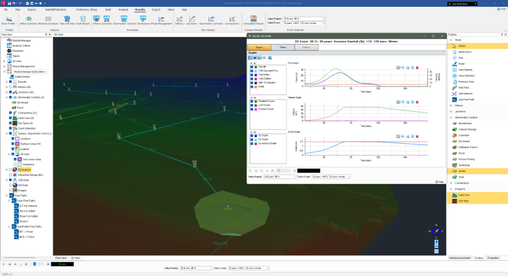
Next, we can take our model and import it directly into InfoDrainage so we can check the hydrology performance of the design by running various scenarios. We can then build our all-important SuDS features.
You can take you Civil design into InfoDrainge directly from the Civil 3D ribbon.

InfoDrainage is evolving fast so if you can, keep it up to date. In here, you can take your drainage network and surface directly from the civil model and analyse it using the Flood Studies Report or the Flood Estimation Handbook. If you are outside of the UK there are various rainfall methods available and even if you are not covered by the supplied tools, you can create your analysis using IDF (intensity, duration and frequency) and temporal curves.
In here you can size your pipes and structures based on the rainfall data and design various stormwater controls. When you are done, you can output reports, images and videos then send the model back to Civil 3D to finalise tour detailed design.
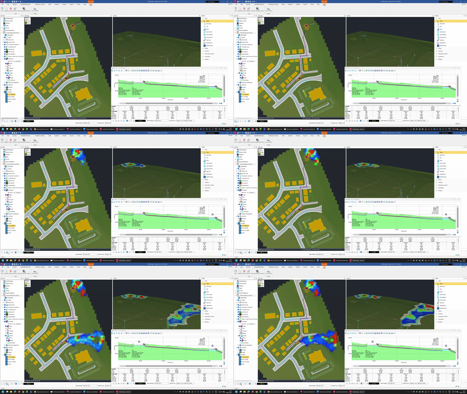
Detailed Design and Documentation with AutoCAD Civil 3D
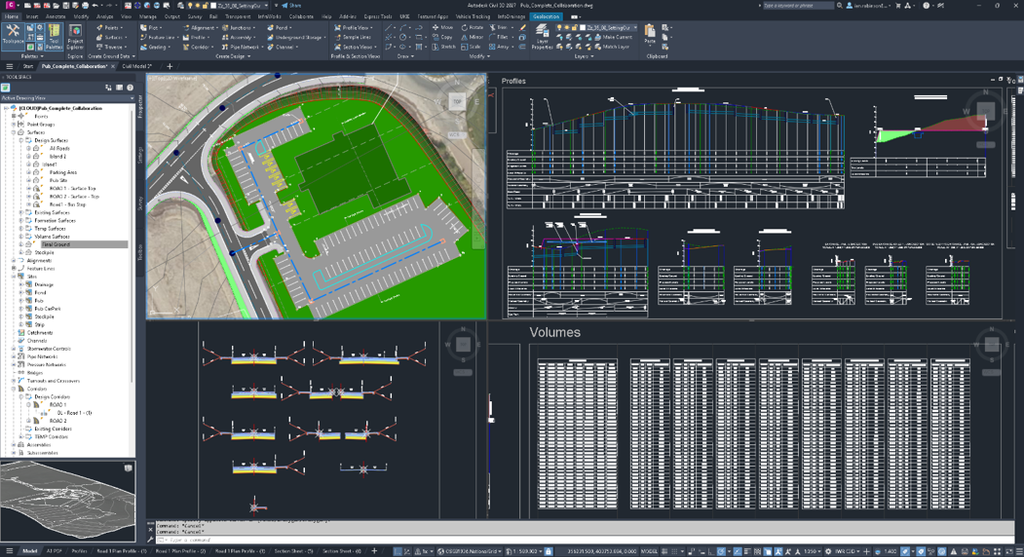
In later blogs, I’ll talk more about Civil 3D and the specific tasks we all have to do, but for this blog I’m looking at the wider context of workflows.
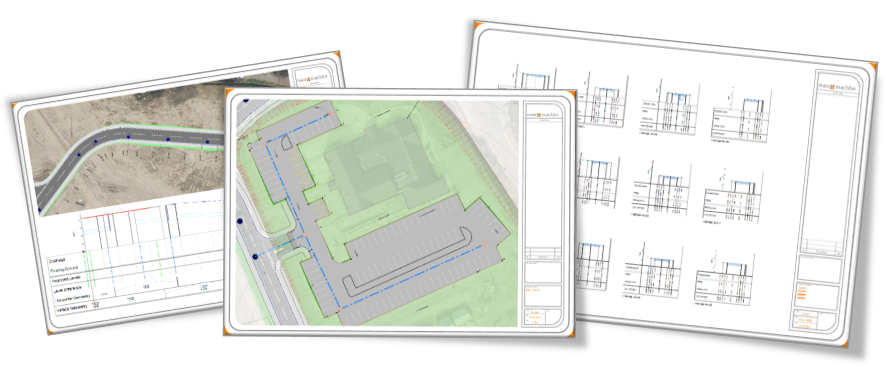
To communicate your design, many of us push the model back into InfraWorks where we can generate images and videos for presentations or engagement meetings. You could take it to the next level with Autodesk 3ds Max where you can import your Civil 3D model and create compelling photo realistic images and animated videos.
There is never one solution, so a connected suite of solutions is going to be the best choice.
I’ll finish off by noting that Civil 3D has AutoCAD Map 3D built in, so we can do all our constraint checking in the early stages or export to users of any GIS tool such as ESRI, QGIS or even Google Earth. Those that know me will be surprised that I’ve skipper over that.. it’s because it’s my favourite subject and deserves a whole lot more than a footnote in a blog, so I’ll be going more blogs dedicated to this subject.
Still got Questions?
Book Training
Our Civil 3D training will teach everything you need for surveying, mapping, design, documentation and analysis. It’ is designed for Civil Engineers and Surveyors who want to take advantage of the software.
Contact Us
We are here to ensure you receive a consistently high service and quality solutions for your business needs. We promise you won’t regret speaking to us, and if we can’t help you, we will try to find someone that can.